RUSSIAN JOURNAL OF EARTH SCIENCES, VOL. 19, ES5005, doi:10.2205/2019ES000679, 2019
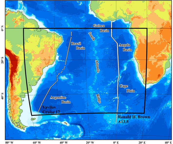
Figure 1. Bottom topography of the South Atlantic based on the GEBCO 2014 data [Weatherall et al., 2015]. The model domain is shown with thick black lines. White dots show the two CTD sections occupied in cruise 17 of the R/V "Akademik Sergey Vavilov" [Morozov, 2005] and A13.5 section in the expedition of the R/V "Ronald H. Brown" [Bullister et al., 2010].

![]()
Citation: Frey D. I., E. G. Morozov, I. Ansorge, V. V. Fomin, N. A. Diansky, R. Yu. Tarakanov (2019), Thermohaline structure of Antarctic Bottom Water in the abyssal basins of the South Atlantic, Russ. J. Earth Sci., 19, ES5005, doi:10.2205/2019ES000679.
Copyright 2019 by the Geophysical Center RAS.
Generated from LaTeX source by ELXfinal, v.2.0 software package.