RUSSIAN JOURNAL OF EARTH SCIENCES, VOL. 19, ES4006, doi:10.2205/2019ES000672, 2019
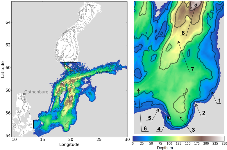
Figure 1. Left panel: Map of the high resolution model domain (filled colors) with the open boundary locations (black lines). The coarse resolution model domain (blank contours + filled colors) has an open boundary close to the Gothenburg station. Right panel: Close-up of the Southeastern Baltic Sea. 1 – Sambian Rise, 2 – Cape Taran, 3 – Gulf of Gdansk, 4 – Hel Spit, 5 – Cape Rozewie, 6 – Slupsk Furrow, 7 – Hoburg Channel, 8 – Gotland Deep.

![]()
Citation: Zhurbas Victor, Germo Väli, Andrey Kostianoy, Olga Lavrova (2019), Hindcast of the mesoscale eddy field in the Southeastern Baltic Sea: Model output vs satellite imagery, Russ. J. Earth Sci., 19, ES4006, doi:10.2205/2019ES000672.
Copyright 2019 by the Geophysical Center RAS.
Generated from LaTeX source by ELXshort, v.2.0 software package.