RUSSIAN JOURNAL OF EARTH SCIENCES, VOL. 19, ES4005, doi:10.2205/2019ES000669, 2019
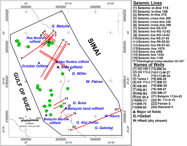
Figure 4. Location map of wells and seismic sections used in the model building, eastern part of the Gulf of Suez.

![]()
Citation: Tarshan Ahmed, Sergey Shimanskiy (2019), Petroleum system modelling and identification of promising oil and gas bearing objects in the eastern part of the Gulf of Suez, Egypt, Russ. J. Earth Sci., 19, ES4005, doi:10.2205/2019ES000669.
Copyright 2019 by the Geophysical Center RAS.
Generated from LaTeX source by ELXshort, v.2.0 software package.