RUSSIAN JOURNAL OF EARTH SCIENCES, VOL. 19, ES4002, doi:10.2205/2019ES000663, 2019
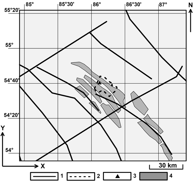
Figure 1. Scheme of fault tectonics of the Leninsky coal deposit based on data of [Lazarevich and Polyakov, 2009; Novikov et al., 2013; Yakovlev et al., 2013] and borders of main mine fields (Database of State Geological Maps, All-Russian Scientific Research Geological Institute named A. P. Karpinsky of the RAS, Electronic resource, URL: http://webmapget.vsegei.ru/index.html, reference date: 10.09.2018): 1 – tectonic faults; 2 – agglomeration of Leninsk-Kuznetsky city; 3 – Leninsk-Kuznetsky city; 4 – mine fields of LCD scheduled to mining, which refer to the area of the supposed dispersion of rocks.

![]()
Citation: Manevich A. I., K. S. Kolikov, E. A. Egorova (2019), Geoecological aspects of stress-strain state modeling results of Leninsky coal deposit (Kuzbass, Russia), Russ. J. Earth Sci., 19, ES4002, doi:10.2205/2019ES000663.
Copyright 2019 by the Geophysical Center RAS.
Generated from LaTeX source by ELXshort, v.2.0 software package.