RUSSIAN JOURNAL OF EARTH SCIENCES, VOL. 21, ES1007, doi:10.2205/2020ES000757, 2021
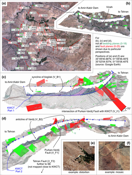
Figure 5. Mapping of the Vineh Structure with FaultTrace: (a) 2D view showing distributions of lineament orientations of bedding and fault planes; (b) 3D view showing bedding plane elements; (c, d) 3D views showing bedding and fault plane elements; (e, f) examples of distortion effects and mosaic tiles in Google Earth (imagery from Google Earth Pro, 2020). The cross-section inserted in (c) and (d) is provided by Sadeghi [2010]; it shows only the first part of the Karaj Water Conveyance Tunnel (KWCT).

![]()
Citation: Faber R., G. Domej (2021), 3D computer-assisted geological mapping: testing WinGeol's FaultTrace for semi-automatic structural geological assessment, Russ. J. Earth Sci., 21, ES1007, doi:10.2205/2020ES000757.
Copyright 2021 by the Geophysical Center RAS.
Generated from LaTeX source by ELXfinal, v.2.0 software package.