RUSSIAN JOURNAL OF EARTH SCIENCES, VOL. 21, ES1005, doi:10.2205/2020ES000751, 2021
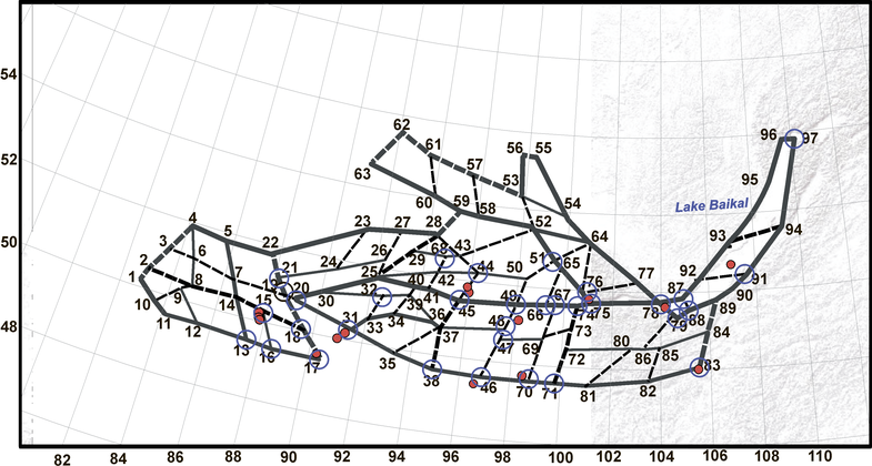
Figure 2. Morphostructural map of the Altai-Sayan-Baikal region. Continuous lines mark the longitudinal lineaments, dashed lines depict the transverse lineaments. Bold lines show the lineaments of the 1st rank, middle lines mark the lineaments of the 2nd rank, hairlines depict the lineaments of the 3rd rank. Red dots depict epicentres of earthquakes $M6+$. A – Altai, WS – Western Sayan, EW – Eastern Sayan, B – Baikal, T – Tuva Mountains. Roman figures indicate numbers of nodes.

![]()
Citation: Gorshkov A. I., A. A. Soloviev (2021), Recognition of earthquake-prone areas in the Altai-Sayan-Baikal region based on the morphostructural zoning, Russ. J. Earth Sci., 21, ES1005, doi:10.2205/2020ES000751.
Copyright 2021 by the Geophysical Center RAS.
Generated from LaTeX source by ELXfinal, v.2.0 software package.