RUSSIAN JOURNAL OF EARTH SCIENCES, VOL. 18, ES6001, doi:10.2205/2018ES000632, 2018
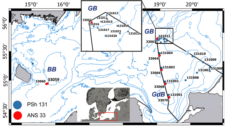
Figure 1. Map of the study site. Dots indicate the sampling stations during the 131st cruise of the R/V Professor Shtokman (March–April 2016, PSh131) and the 33rd cruise of the R/V Akademik Nikolai Strakhov (October–December 2016, ANS33). (BB is the Bornholm Basin, GB is the Gotland Basin, GdB is the Gdansk Basin).

![]()
Citation: Ponomarenko E. P., V. A. Krechik (2018), Benthic foraminifera distribution in the modern sediments of the Southeastern Baltic Sea with respect to North Sea water inflows, Russ. J. Earth Sci., 18, ES6001, doi:10.2205/2018ES000632.
Copyright 2018 by the Geophysical Center RAS.
Generated from LaTeX source by ELXpaper, v.1.5 software package.