RUSSIAN JOURNAL OF EARTH SCIENCES, VOL. 18, ES2003, doi:10.2205/2018ES000617, 2018
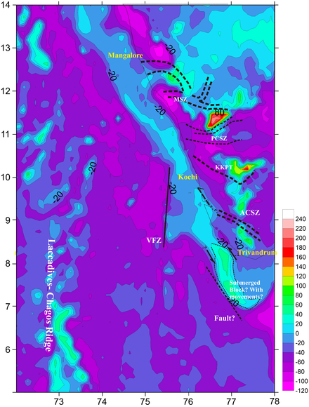
Figure 7. Satellite derived Gravity map (from topex) with inferred faults and submerged continental crust/Trivandrum block?. The Sigmoidal shape of the submerged portion indicate major tectonic movement. The probable direction of movement of submerged block is also marked.

![]()
Citation: Girishbai Drishya, Arun Bhadran (2018), An integrated approach on satellite geodesy data to delineate morphotectonic and neotectonic activities in the West Coast off Kerala, Southern India, Russ. J. Earth Sci., 18, ES2003, doi:10.2205/2018ES000617.
Copyright 2018 by the Geophysical Center RAS.
Generated from LaTeX source by ELXpaper, v.1.5 software package.