RUSSIAN JOURNAL OF EARTH SCIENCES, VOL. 12, ES4001, doi:10.2205/2012ES000516, 2012
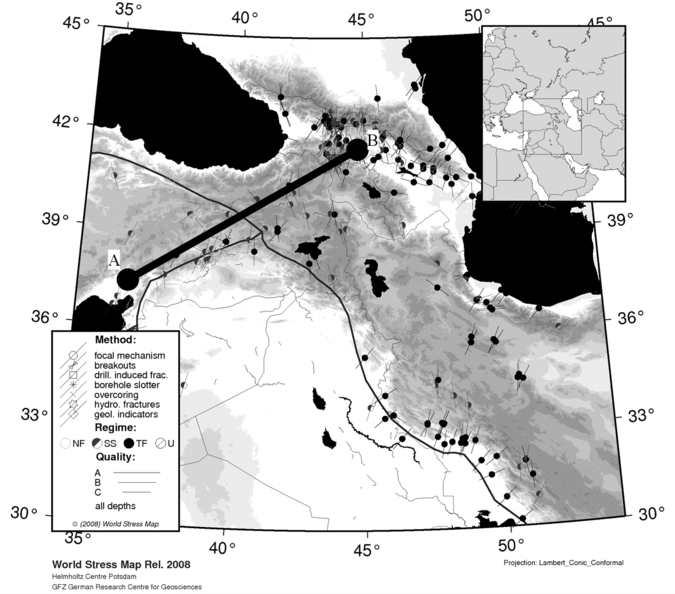
Figure 10. Topographic map of the Eastern Anatolian region with the WSM data (CASMO map generated by the WSM website, [
![]()
![]()
Citation: Haderka P., A. N. Galybin (2012), Plastic stress field reconstruction based on stress orientations data, Russ. J. Earth Sci., 12, ES4001, doi:10.2205/2012ES000516.
Copyright 2012 by the Geophysical Center RAS.
Generated from LaTeX source by SemTeXML, v.1.2) software package.